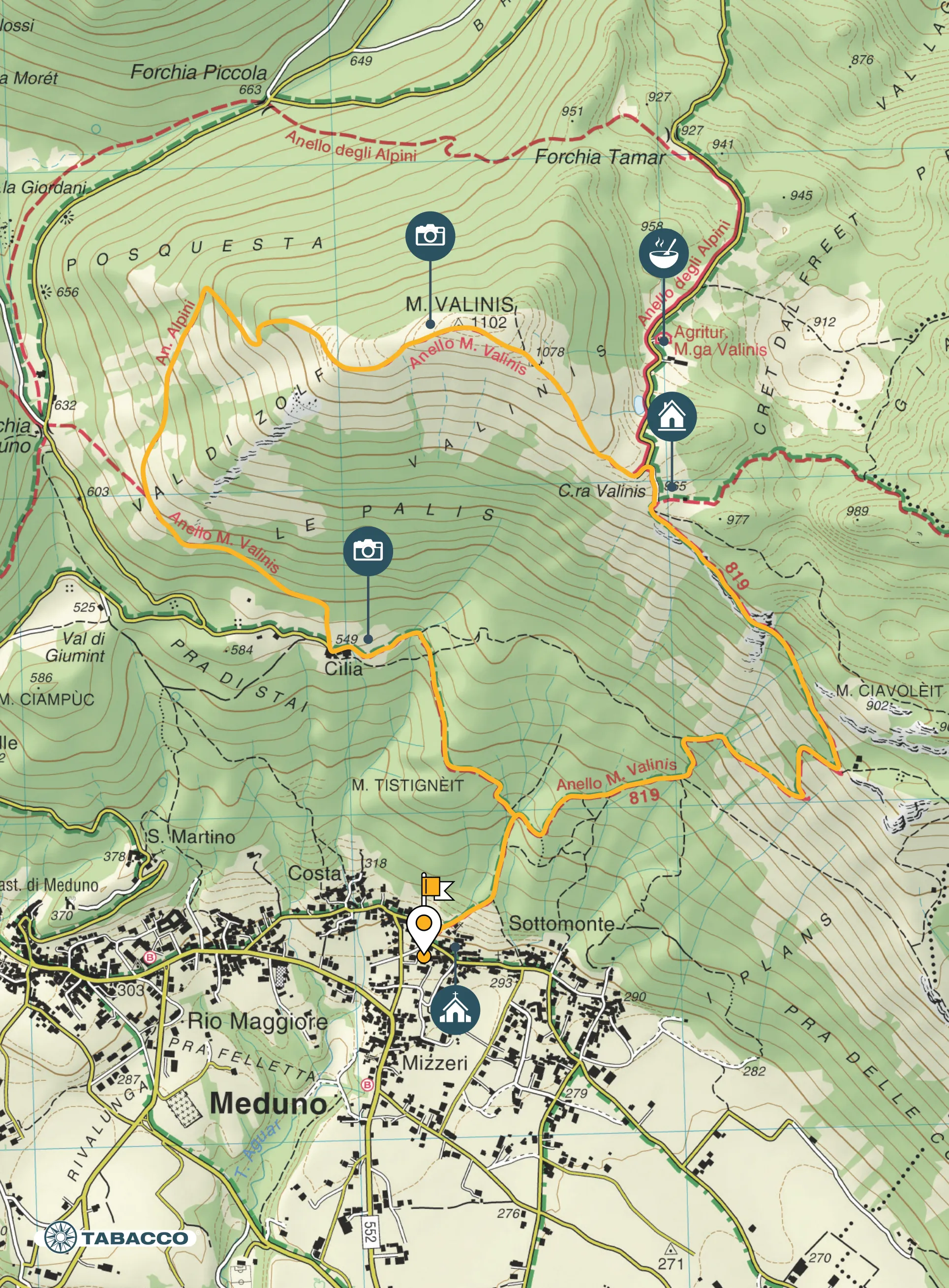
Itinerary
From the little church in Sottomonte (300 m asl), take the CAI path 819, which runs alongside the stream and enters the dense woods. As the altitude rises, the vegetation tends to decrease, giving way to beautiful views of the Friulian plain and the Carnic foothills. Arriving at the Casera Valinis near the paraglider take-off area, leave the CAI path that continues to the right and follow the mountain’s summit ridge to the left to reach the summit cross (1102 m asl). From here, the panorama is 360° over the Dolomites, the Julian Alps, the Carnic Alps, the Adriatic coast and the Veneto-Friuli plain. Descend along the Val Di Zolf Valley, following the signs for the Mount Valinis Circular Trail, and at an altitude of 700 m at the fork near the Forchia di Meduno, bear left and, passing through the hamlet of Cilia and the woods of Monte Tistingneit (Mount Chestnut Grove), return to the starting point.
Curiosity
Mount Valinis is especially famous for free-flying, paragliding and hang-gliding activities. Every year, thousands of sportsmen and women from all over Europe come here to launch themselves from its summit, thanks to the generally stable and favourable winds that allow them to practice these disciplines.
Technical details
Distance: 7,8 km
Drop: 825 m
Stops
CAI Path 819 /
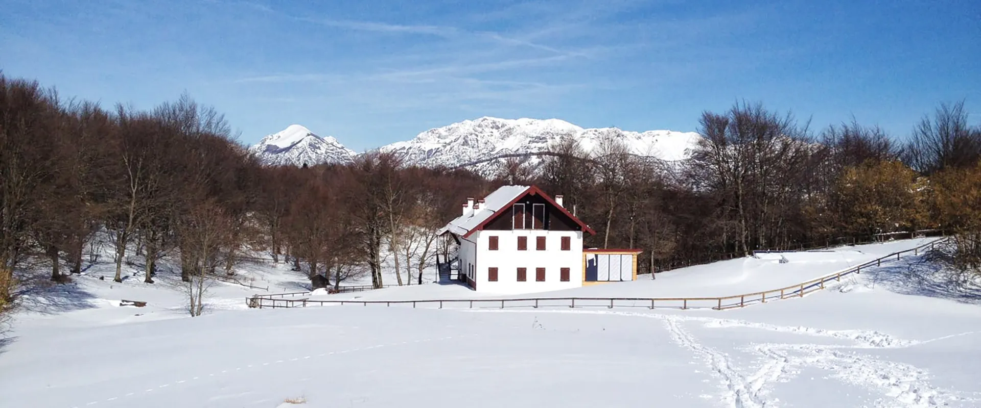
Malga Valinis /
Forchia di Meduno /
Cila /
Accessibility
Hiking

Map